1
/
of
1
National Oceanic and Atmospheric Administration (NOAA)
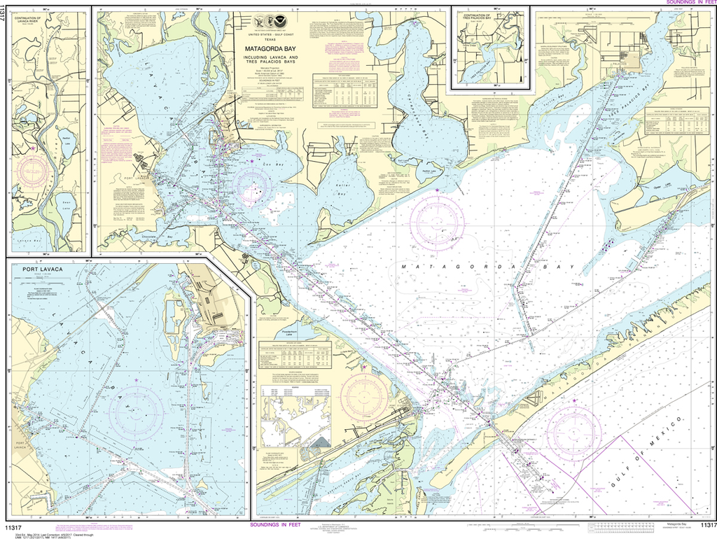
NOAA Chart 11317: Matagorda Bay including Lavaca and Tres Palacios Bays, Port Lavaca, Continuation of Lavaca River, Continuation of Tres Palacios Bay
NOAA Chart 11317: Matagorda Bay including Lavaca and Tres Palacios Bays, Port Lavaca, Continuation of Lavaca River, Continuation of Tres Palacios Bay
Regular price
$23.75 USD
Regular price
Sale price
$23.75 USD
Unit price
/
per
Shipping calculated at checkout.
Couldn't load pickup availability
The chart you are viewing is NOT updated weekly and does NOT include all the of the latest Notice to Mariners corrections.
Region: Gulf Coast & Caribbean Islands
Paper Size: 50" x 36"
Chart Image Size: 35" x 47"
Scale: 1:50,000
Share