1
/
of
1
National Oceanic and Atmospheric Administration (NOAA)
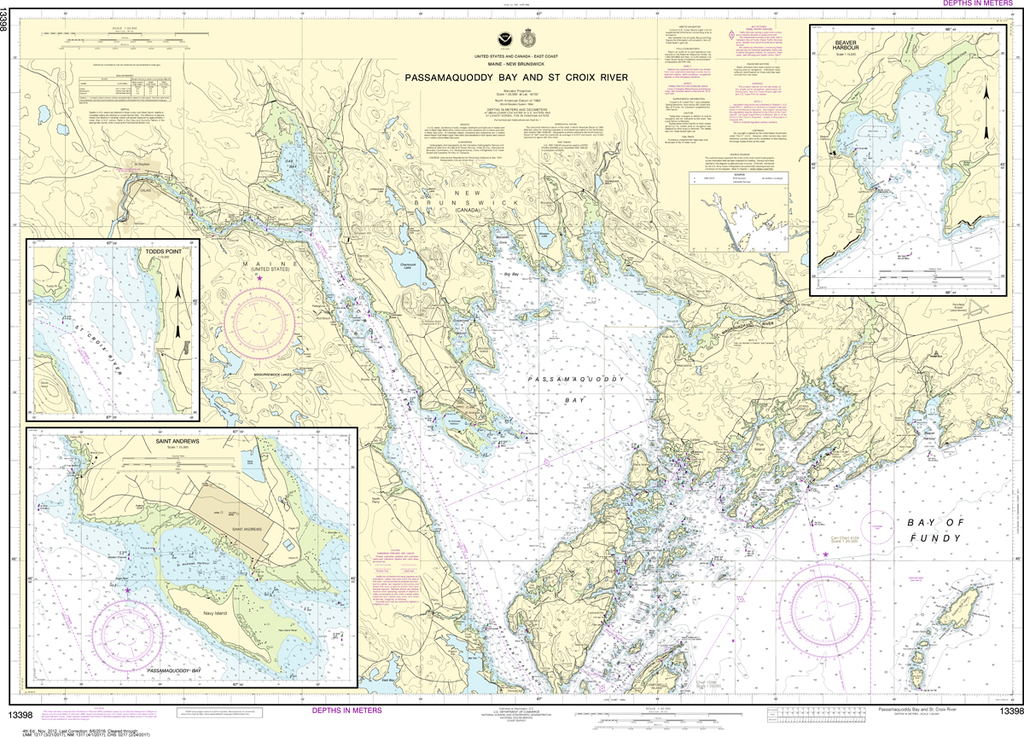
NOAA Chart 13398: Passamaquoddy Bay and St. Croix River, Beaver Harbor, Saint Andrews, Todds Point
NOAA Chart 13398: Passamaquoddy Bay and St. Croix River, Beaver Harbor, Saint Andrews, Todds Point
Regular price
$23.75 USD
Regular price
Sale price
$23.75 USD
Unit price
/
per
Shipping calculated at checkout.
Couldn't load pickup availability
Region: Northeast Atlantic
Paper Size: 48" x 36"
Chart Image Size: 32" x 45"
Scale: 1:50,000
Share