1
/
of
1
National Oceanic and Atmospheric Administration (NOAA)
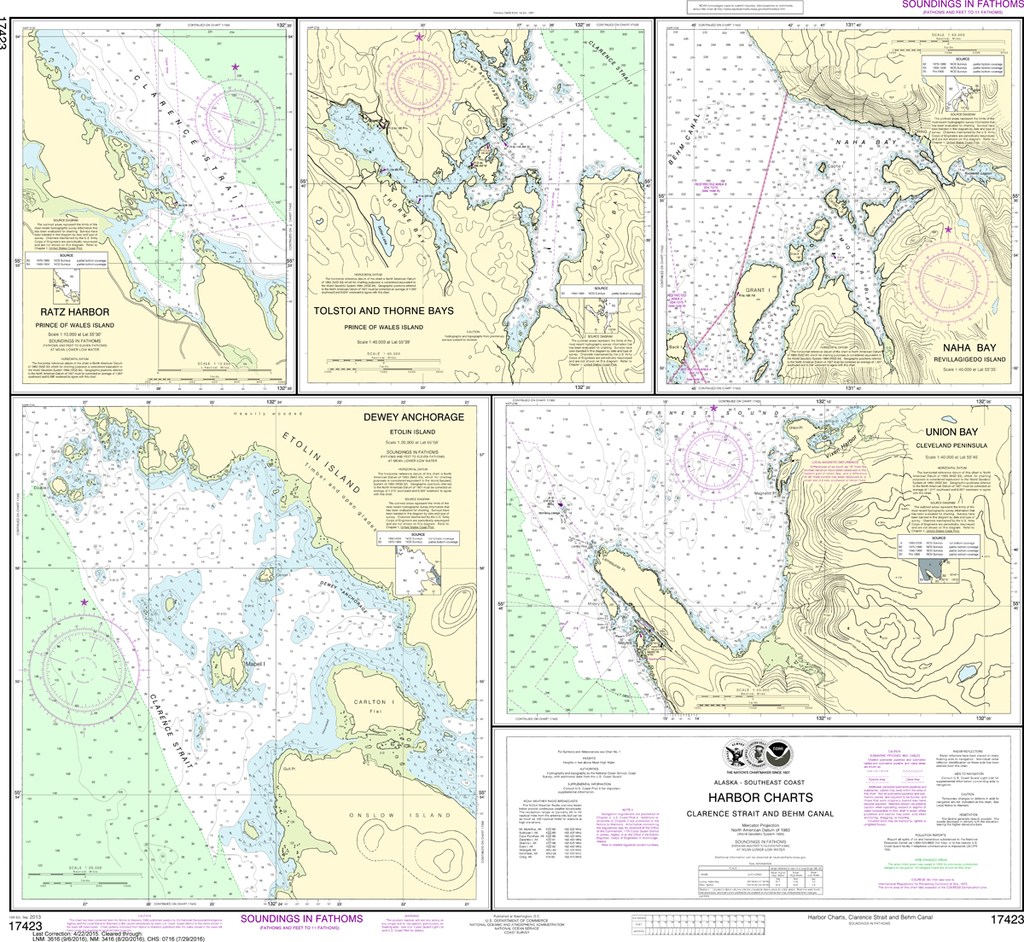
NOAA Chart 17423: Harbor Charts - Clarence Strait and Behm Canal, Dewey Anchorage, Etolin Island, Ratz Harbor, Prince of Wales Island, Naha Bay, Revillagigedo Island, Tolstoi and Thorne Bays, Prince of Wales ls, Union Bay, Cleveland Peninsula
NOAA Chart 17423: Harbor Charts - Clarence Strait and Behm Canal, Dewey Anchorage, Etolin Island, Ratz Harbor, Prince of Wales Island, Naha Bay, Revillagigedo Island, Tolstoi and Thorne Bays, Prince of Wales ls, Union Bay, Cleveland Peninsula
Regular price
$23.75 USD
Regular price
Sale price
$23.75 USD
Unit price
/
per
Shipping calculated at checkout.
Couldn't load pickup availability
The chart you are viewing is NOT updated weekly and does NOT include all the of the latest Notice to Mariners corrections.
Region: Alaska Coast
Paper Size: 34" x 36"
Chart Image Size: 30" x 33"
Scale: 1:20,000
Share