National Oceanic and Atmospheric Administration (NOAA)
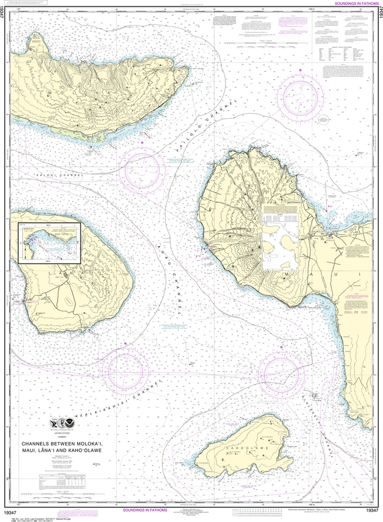
NOAA Chart 19347: Channels between Molokai, Maui, Lana'i and Kaho'olawe, Manele Bay
NOAA Chart 19347: Channels between Molokai, Maui, Lana'i and Kaho'olawe, Manele Bay
Couldn't load pickup availability
The chart you are viewing is NOT updated weekly and does NOT include all the of the latest Notice to Mariners corrections.
THIS CHART IS CURRENTLY CANCELED BY NOAA.
We know there are many questions about NOAA charts, newest editions and charts being cancelled. The U.S. Office of Coast Survey provides an updated list of all chart updates and the ones being cancelled. You can find those here: https://www.charts.noaa.gov/MCD/Dole.shtml
As charts are being cancelled, please know these are now NOT suitable for navigation as the chart is not being updated weekly and does NOT include all of the latest Notice To Mariners
Region: Hawai'ian & Pacific Islands
Latest Edition: 19 Ed. (1-Jun-2014)
Last Correction: 1-Nov-2019
Cleared Through: NTM 47/2019 (23-Nov-2019)
Paper Size: 49" x 36"
Chart Image Size: 46" x 33"
Scale: 1:80,000
Share